If you are looking to explore the iconic Nahanni River but want a more hands-on, active paddling experience, packrafting provides the perfect adventure!
Our Nahanni packrafting experience is unique in the industry. Combining the comforts of a multi-day rafting expedition with the freedom to personally connect with the river, you will enjoy the best of both worlds.
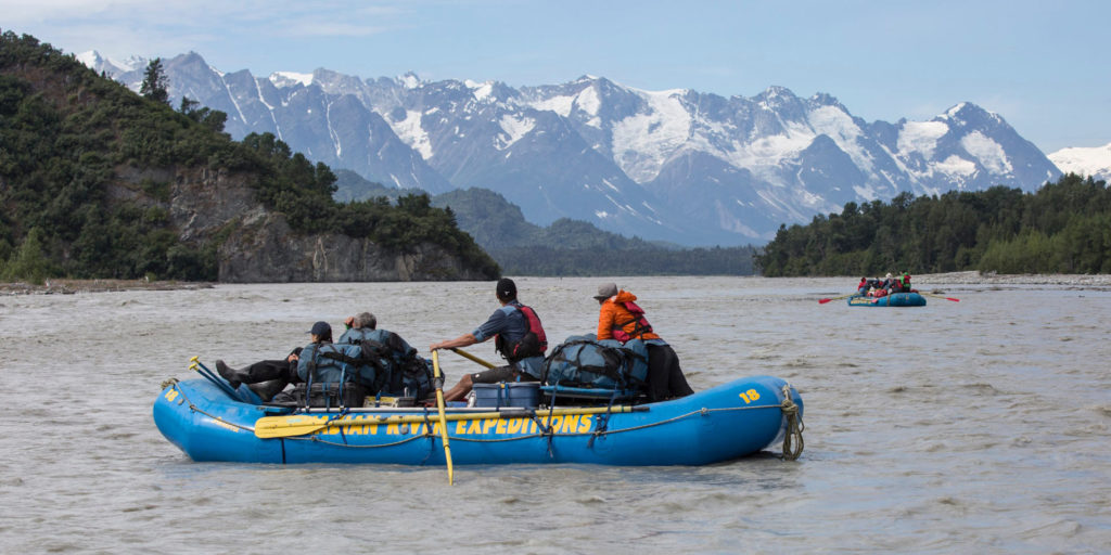
On our 1-week and 12-day Nahanni raft journeys, you’ll savour four-course meals, enjoy a hot camp shower, and have all the comforts of home packed into our 18-foot rafts — all while experiencing the exhilaration of paddling down the river yourself!
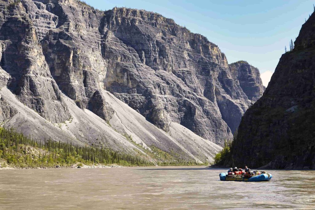
Imagine hearing the sound of glacial silt hissing against your boat as you paddle through limestone canyons, walls towering more than a kilometre high in all directions. Picture the stillness and peaceful solitude of the river as you float through the one last true wildernesses on the planet.
What is a packraft? - A short history of packable rafts
A packraft is a lightweight, durable and inflatable boat, designed to fit inside a backpack. They were conceptualized over 150 years ago; the history of packrafting can be traced all the way back to the Franklin expedition of 1845 through the Northwest Passage. The ill-fated voyage featured small rubber packrafts, designed and constructed by the renowned lightweight boat maker and Canadian Arctic explorer Peter Halkett.
Later, inflatable “packable” rafts started to surface in army surplus shops, repurposed from surplus survival gear once used in World War II aircraft. Originally conceived as vital survival tools, these early packrafts laid the foundation for their future use as some of the most versatile and widely used “adventure-mobiles”. Suddenly even the remotest places became accessible, and explorers across the globe were inspired to explore new lands.
Contemporary packrafts have been thoughtfully engineered; our models are self bailing, removing the need for a spray skirt to keep the water out. These crafts are incredibly tough and forgiving, and lend themselves beautifully to your active holiday on the Nahanni River!

Highlights of Packrafting the Nahanni River
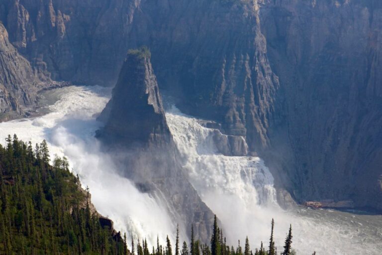
Geological Wonders: In 1978, the Nahanni River was designated the world’s first UNESCO World Heritage site for its beauty and unique geology. It boasts Canada’s deepest canyons (up to 1,500 metres deep!) and the wonders of Nailicho (Virginia Falls) – twice the height of Niagara!
Diverse Wildlife: The Nahanni watershed is home to exquisite northern biodiversity. Iconic species such as moose, grizzly bears, peregrine falcons and golden eagles make their home in the river corridor. Dall sheep can often be spotted wandering along the tops of the canyon walls at dusk, making for a truly indelible wildlife watching experience!
Captivating History: The Nahanni River has been central to Dene culture since time immemorial. Guests will have the opportunity to learn about the river’s rich Indigenous history as well as the settler legacy from more recent explorers.
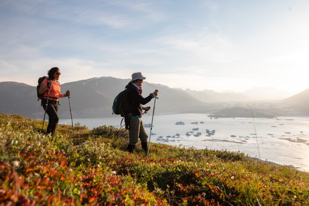
World Class Hiking: Our 12 Day itinerary builds in time to explore the watershed on foot, promising awe-inspiring hiking opportunities. One highlight is Sunblood Mountain – a 16km round trip hike topping out at 1600 metres, with breathtaking views of Nailicho, the Ragged Range and South Nahanni watershed. The canyon rims also offer exciting opportunities for exploration, granting you a spectacular aerial perspective over the river below.

What gear do I need?
If you are renting one of our packrafts, we will provide you with a wetsuit and helmet. We’d recommend having a sturdy pair of shoes that you don’t mind getting wet (see our ultimate guide to footwear here).
We’ll also provide you with a 20L dry bag so you can store your snacks, water, sunscreen and an extra layer with easy access throughout the day.
Check out our blog post Packing For Your River Trip Made Easy for an in-depth guide on how to prepare for your Nahanni River adventure!
What is the whitewater like on the Nahanni River?
Most of the river is fairly mellow, but there are several rapid sections for those seeking extra excitement. Fourth Canyon below Nailicho (Virginia Falls), Wrigley’s Tricky Currents, Figure 8 Rapid, George’s Riffle, and Lafferty’s Riffle all have fun, splashy Class II/III whitewater.
Experience the adventure of packrafting the Nahanni River for yourself!
Now that you have discovered why the packraft is the ultimate adventure rig, check out our 1 Week and 12 Day Nahanni River Raft Journeys!
Packed with captivating history, fantastic opportunities for wildlife watching and photography, and exquisite hiking, the Nahanni River is the ultimate destination for outdoors addicts, active adventurers and wildlife lovers alike!
Our friendly Expedition Planning Team would be delighted to connect with you and help you plan your journey of a lifetime.